Copyright©
AdobeStock l Kedsara
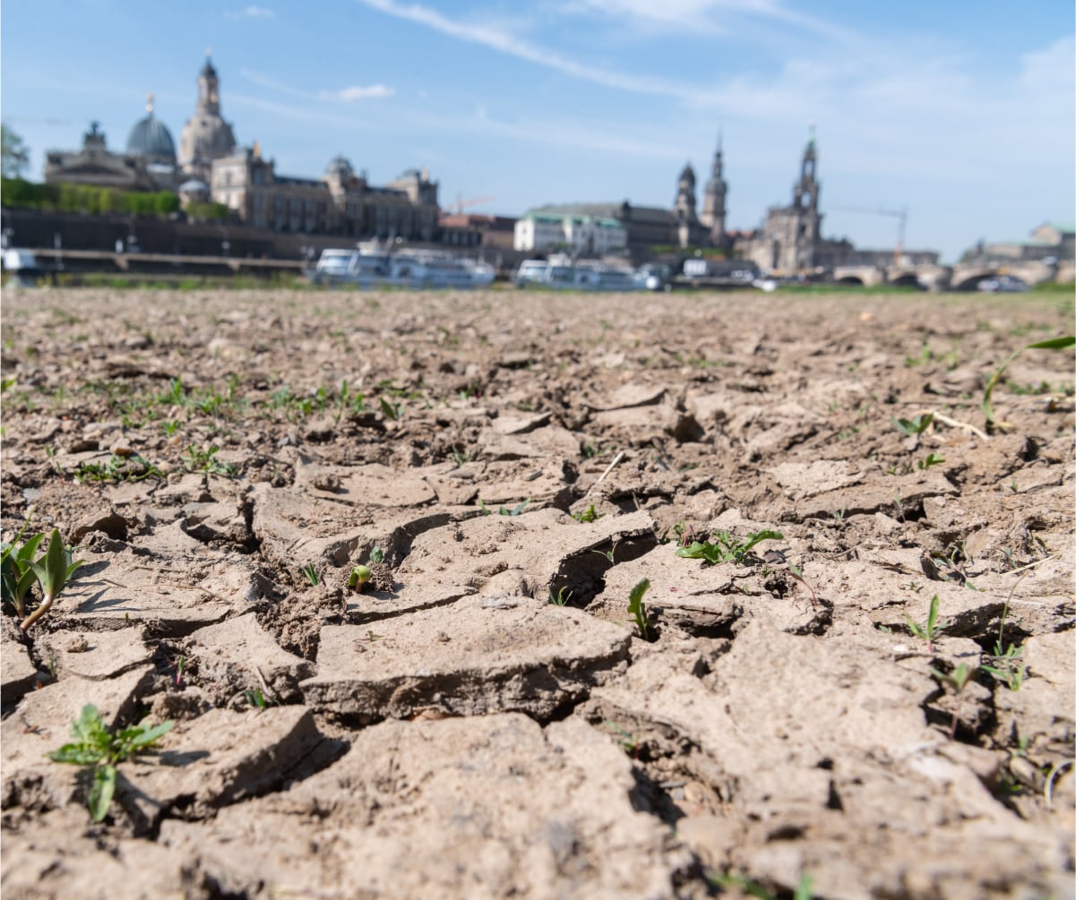
Cities are increasingly characterized by overheating. The data available on specific overheating processes in the city is sparse. As part of the Smart-City project MAtchUP, the work on IoT and data processing was used to initiate the KLIPS project, which deals with precisely this topic. AI models are being tested to process measurement data for the city.
To create sustainable and liveable cities that can cope with the current challenges of climate change and urbanization. This includes improved management of the increasing overheating in the city on the basis of measurement data and small-scale forecasting. To this end, a comprehensive sensor network for measuring temperature and humidity is being set up in the model cities.
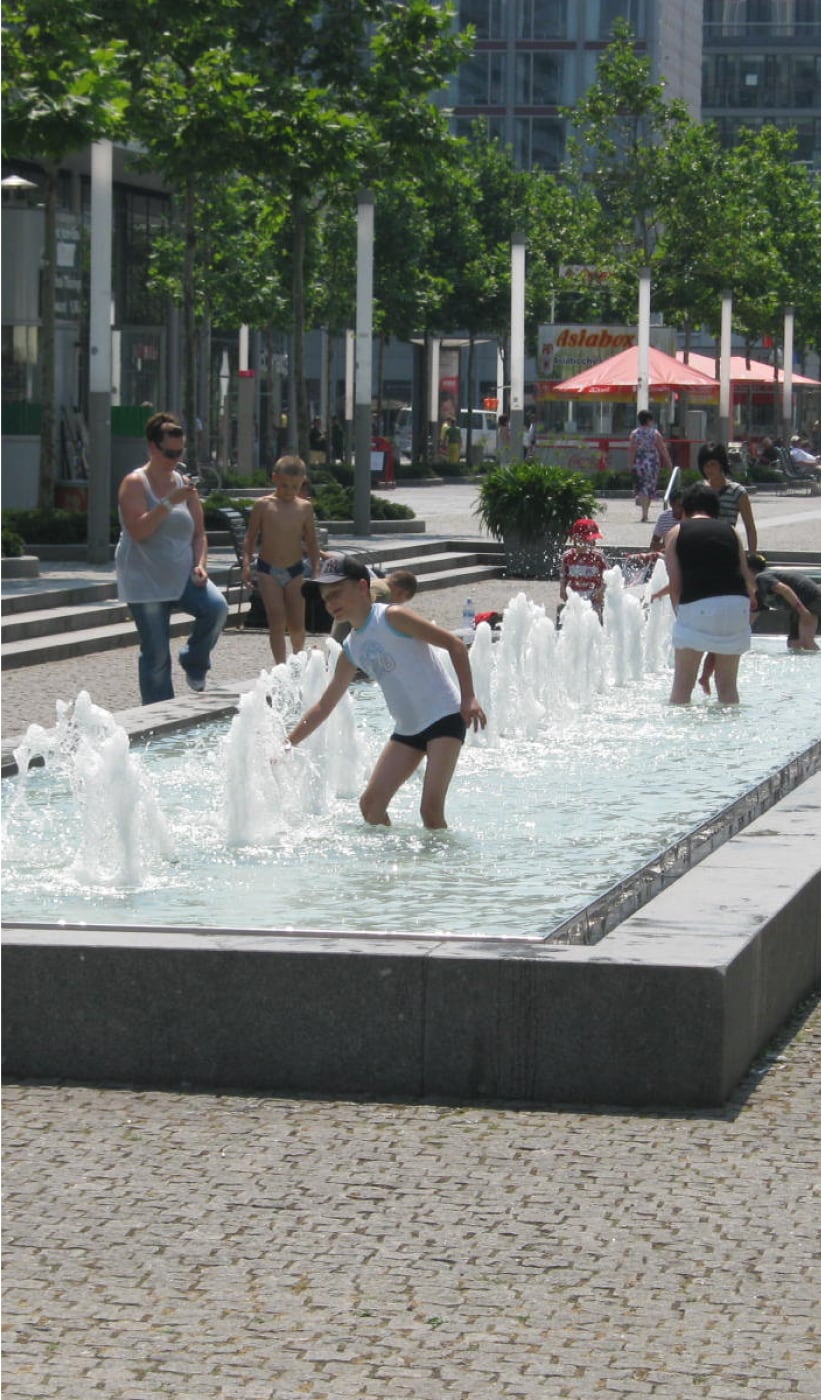
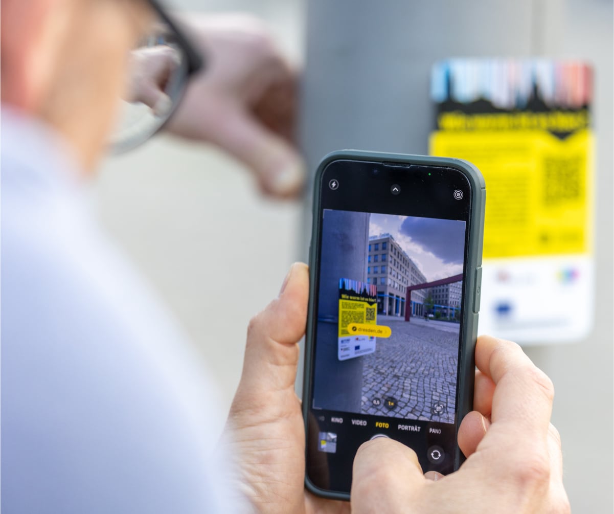
KLIPS is initially a research project. The impact is long-term. Nevertheless, KLIPS will bring concrete improvements to the everyday lives of Dresden's residents. With information from the sensors installed in the city, hot places and streets can be better identified and redesigned in the long term. We understand the temperature landscape of our city better and can also derive real-time heat reports and heat protection tips from this.
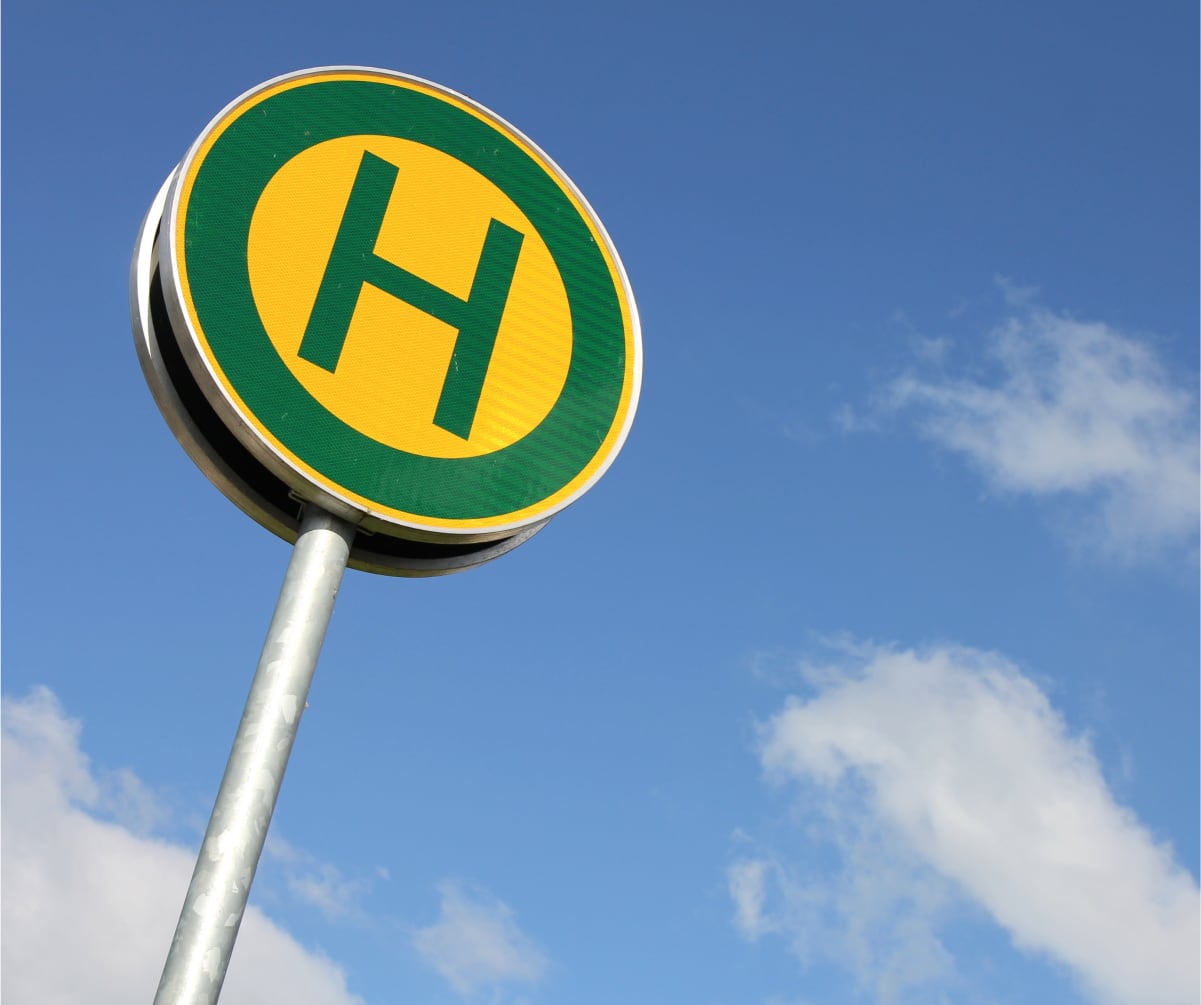
KLIPS is a climate adaptation project, but it still has a connection to mobility. If you're waiting for a bus or streetcar at a stop, you don't want to be stuck in a heatwave. Accordingly, DVB is interested in "healthy stops" and uses the findings from KLIPS.
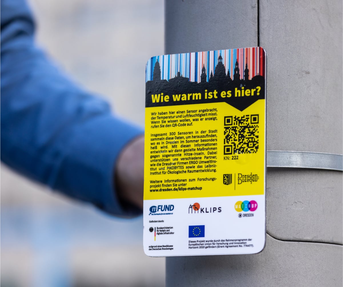
300 sensors had to be installed. The Pikobytes team used sustainable cargo bikes to install the devices on poles and lampposts in the city. The measurements also ensure that better buildings can be constructed in the long term.
The results of KLIPS open up opportunities for companies to base their location decisions on relevant environmental factors such as heat development in urban areas and to benefit from the reliability of urban infrastructures or to provide for the health of their employees.
KLIPS focuses on the close link between urban development and technology. By participating in the project, the project participants were able to actively interact with the city administration and thus contribute to the testing of new technologies that will later be implemented on a large scale. An IoT sensor network with innovative transmission options and platforms has been created and will also be available to Dresden in the future.
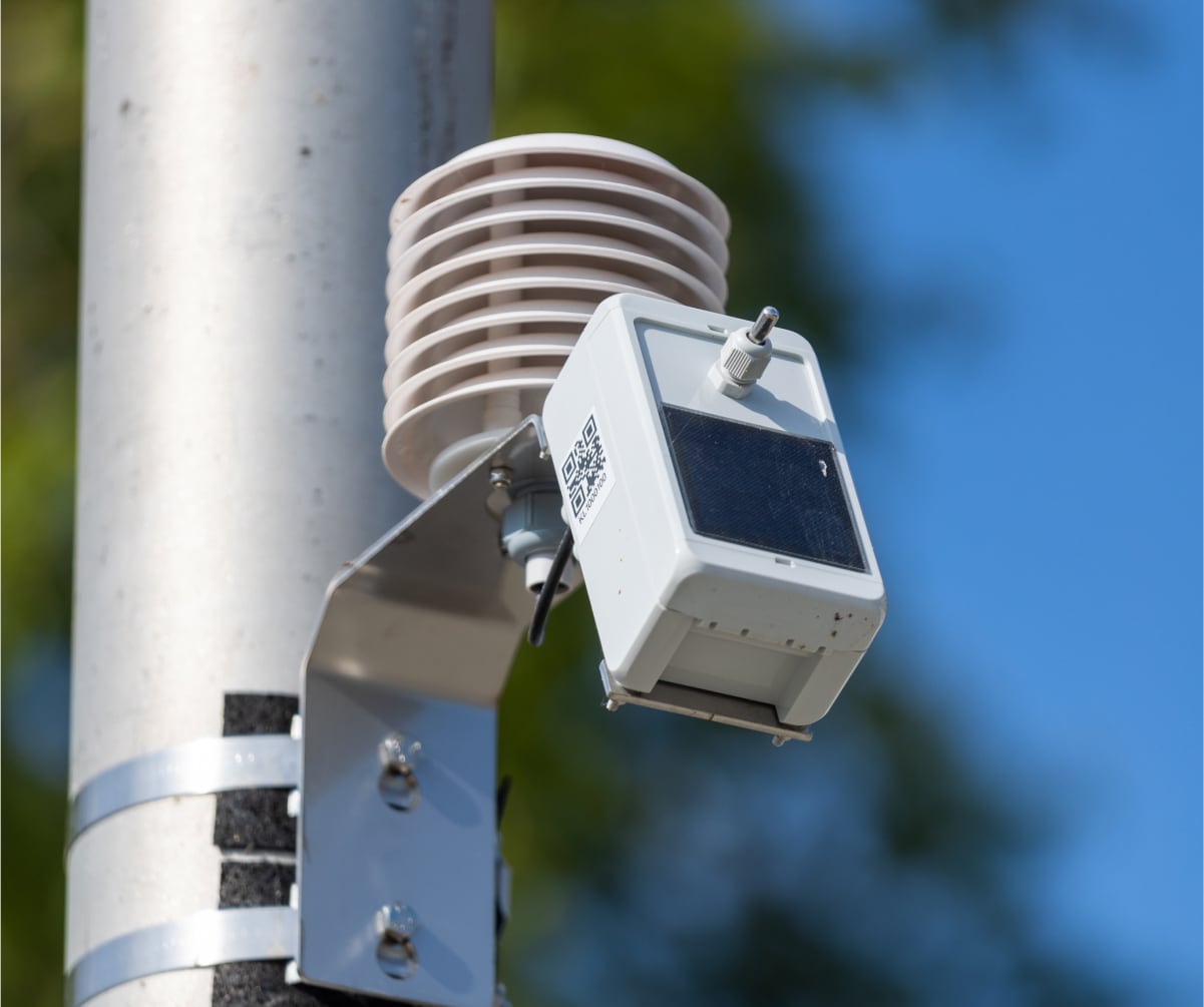
KLIPS is made possible by a sensor network in which the sensors work autonomously and are powered by small PV modules. Accordingly, the small computers that organize the measurement and data transmission must be designed very efficiently to ensure continuous operation. Such an energy-efficient design has been achieved in the project and makes KLIPS a success.
Software development and architecture in the field of web mapping and geodata infrastructures.

ERGO Umweltinstitut GmbH combines the four specialist departments of Environmental Laboratory, Environmental Engineering, Air Pollution Control and Soil and Groundwater Remediation Technology under one roof.
The German Aerospace Center (DLR) is the aeronautics and space research center of the Federal Republic of Germany. Its research and development work in aeronautics, space, energy, transportation and security is integrated into national and international cooperative ventures.

The Institute for Information Systems is the central research facility for computer science at Hof University of Applied Sciences.

We contribute to spatial development that enables people to prosper within ecological limits and ensures planetary justice.

Under the guiding principle of Environmental Data at your Fingertips, PIKOBYTES plans and develops customized solutions for the collection, management and analysis of environmental, infrastructure and geodata. To this end, PIKOBYTES develops powerful databases, intuitive research solutions, interactive visualizations and new concepts for high-density, self-sufficient measurement networks.

Your open source specialist for maps and spatial information systems.
Software AG offers an integrated business transformation suite for process management, enterprise architecture, application modernization and IoT.
Langenfeld represents "a medium-sized city" in the KLIPS research project. The data obtained in the project will help many cities in the future to deal with heat events.